raster2sensor
raster2sensor – Raster-to-Sensor Data Transformation Tool
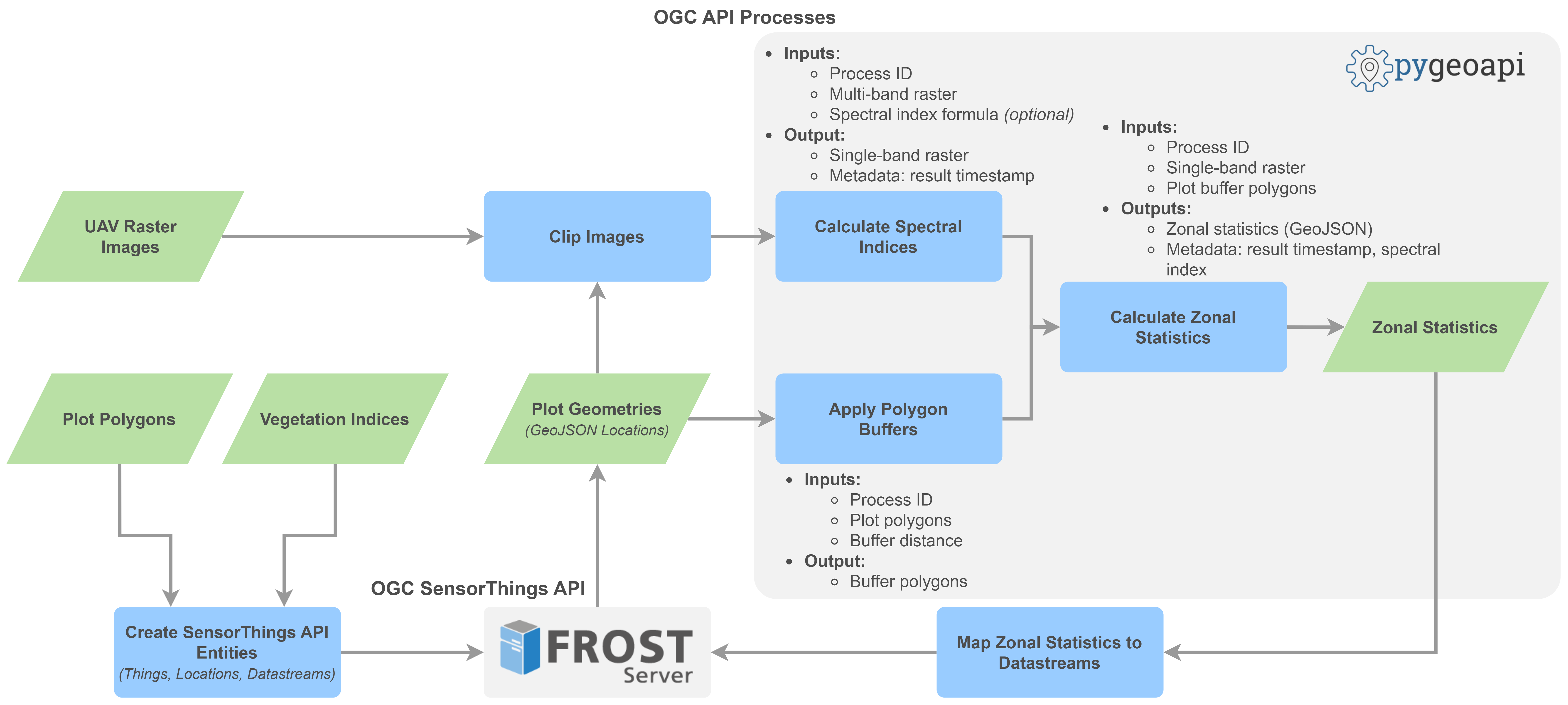
raster2sensor is a software project from the Technical University of Munich's Chair of Geoinformatics. Based on its name and project context, it is intended to bridge raster-based geospatial data and sensor-oriented data representations.
Raster datasets represent spatially distributed information as grid cells, while sensor systems commonly organize information around locations, observed properties, and measurement records. Connecting these representations can support the integration of geospatial data with sensor-data infrastructures.
Purpose and functionality
Raster data are widely used in environmental monitoring, remote sensing, and agricultural research. Converting or associating raster values with sensor-oriented representations can make spatial data easier to integrate into workflows designed around individual observation locations or sensor measurements.
Potential functionality for a raster-to-sensor workflow includes:
- Reading georeferenced raster data.
- Associating raster values with spatial locations or sampling points.
- Representing extracted values in a sensor-oriented data structure.
- Supporting integration with geospatial or sensor-data platforms.
The exact supported raster formats, extraction strategy, output schema, and platform integrations must be confirmed from the repository's documentation and implementation.
Data and Resources
Additional Info
| Field | Value |
|---|---|
| Author |
|
| Maintainer |
|
| Language | |
| Version | |
| Start des Gültigkeitszeitraumes | |
| Ende des Gültigkeitszeitraumes | |
| Spatial extent |
Dataset extent |
| Benutzerdefiniertes Feld |